
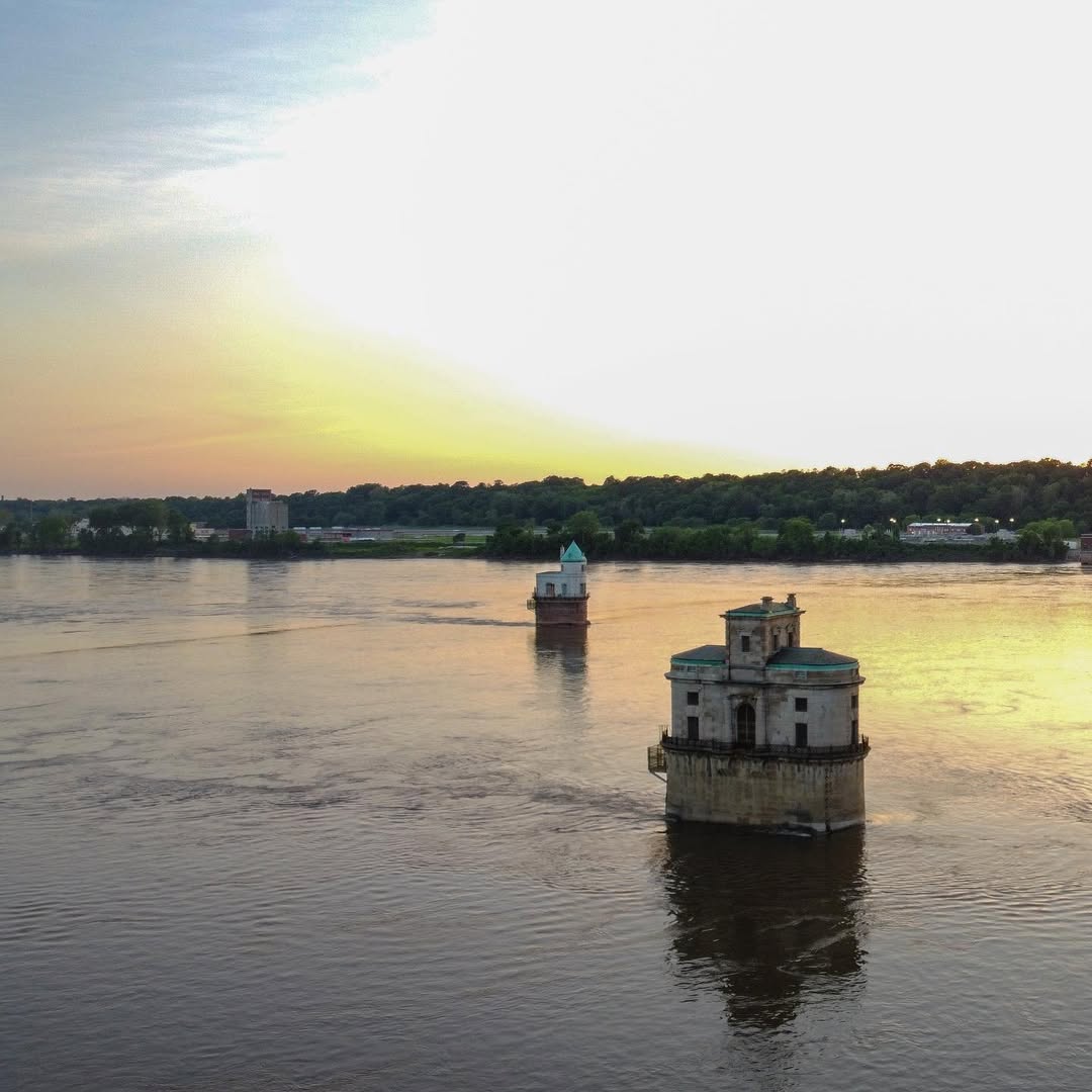
The Chain of Rocks Bridge has a bend in the middle. Not a metaphorical one — an actual 22-degree bend in the span of a bridge crossing the Mississippi River, put there in 1929 because engineers needed to align the bridge with two water intake towers downstream. It's one of those decisions that looks like a mistake until you see it in person and realize it's just a wonderfully strange piece of engineering logic.
The bridge opened as a toll crossing and became part of Route 66 in 1936, serving as one of the highway's five river crossings into St. Louis. It stayed in service until 1967, then sat closed for three decades. In 1999 it reopened as a pedestrian and cycling bridge — the Route 66 Bikeway — and it was listed on the National Register of Historic Places in 2006.
Walking it is something. The bridge is just over a mile long, and the river below you is wide and fast and brown, moving the way big rivers move: with intention. The water intake towers midstream are still there, brick and gothic-looking, a little eerie. The view back toward St. Louis catches the Arch. The view toward Illinois opens out flat.
On a weekday morning it was mostly empty. A few cyclists. A woman walking a dog. The wind was strong enough to hear through the old bridge structure, a low hum that made the whole thing feel more alive than a road should be. This is the kind of bridge you remember. Get out there before you think you're ready to.