
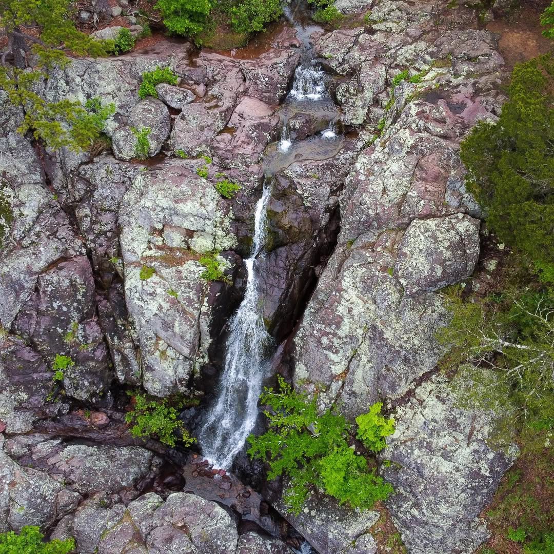
Missouri is not the state you think of when you think waterfalls. But Mina Sauk Falls exists, and it's real, and it drops 132 feet over a series of rhyolite ledges into a pool at the bottom of Taum Sauk Mountain — the highest point in the state. The first time I hiked out to it I half expected something modest. It wasn't.
The falls are inside Taum Sauk Mountain State Park near Ironton, about 90 miles south of St. Louis in the St. Francois Mountains — some of the oldest exposed rock in North America, remnants of ancient volcanic activity that predates most of the continent's familiar geography. The park sits at 1,772 feet, which is the summit of Missouri, and that context is part of the fun of the hike: you're bagging the state highpoint on the way to a waterfall. The 2.9-mile loop trail gains about 436 feet and is rocky, uneven, and genuinely more physical than a lot of Missouri trails. Bring decent shoes.
The falls run best after rain. Mina Sauk is technically a wet-weather waterfall, meaning its flow depends on recent precipitation. After a good storm it roars down the volcanic rock face in multiple streams; during dry summer months it can slow to a trickle or stop entirely. Spring is the safest bet for seeing it at full strength, and the wet-season wildflowers on the surrounding glades are worth factoring in. The trail itself passes through open rocky glades with views across the Ozark hills before dropping down to the falls, and the contrast between the exposed ridge and the forested ravine makes the whole loop feel longer and more varied than the mileage suggests.
The park is free, there's a small parking area at the trailhead, and there's a vault toilet but nothing else. Cell service is unreliable. Bring water, wear something on your ankles that can handle rocky ground, and don't skip this one because Missouri is supposedly too flat for waterfalls. It isn't.